Driving the Causeway Coastal Route is one of the top things to do in Northern Ireland, but planning the perfect itinerary can be a challenge!
Here’s my complete guide to what to see, where to stop, where to eat and where to stay for your Northern Ireland road trip. Read on, and I promise you won’t miss a thing!
This itinerary will take two days. On day 1, you’ll drive the scenic route along the County Antrim coast. from Belfast up to Ballycastle on day 1. This first day is full of sweeping views, sandy beaches and lesser-known attractions like Glenarm Castle’s Walled Garden and Cushendun Caves.
On day 2, you’ll take in the most famous attractions on Northern Ireland’s north coast, including the Carrick-a-Rede rope bridge and the Giant’s Causeway, plus my favourite off-the-beaten-track attraction. I’ve also included ideas for things to do if you have an extra day or two in this stunning part of Northern Ireland.
Causeway Coastal Route map
Save this map for an easy-to-follow itinerary for your Northern Ireland road trip.
Day 1: Belfast to Ballycastle
This Causeway Coastal Route itinerary starts from Belfast. We flew in to Belfast George Best City Airport (map), which is just outside Belfast city centre and right on the motorway network, so it’s really convenient if you’re taking a road trip up the Causeway Coast. Belfast’s other airport, Belfast International (map) is 20 miles to the west of the city, so if you can, choose City Airport.
We rented a car from Budget but there are a few other companies with rental desks in the terminal building. I used Booking.com to compare prices.
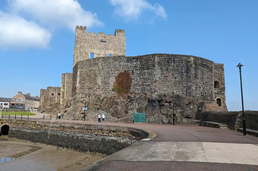
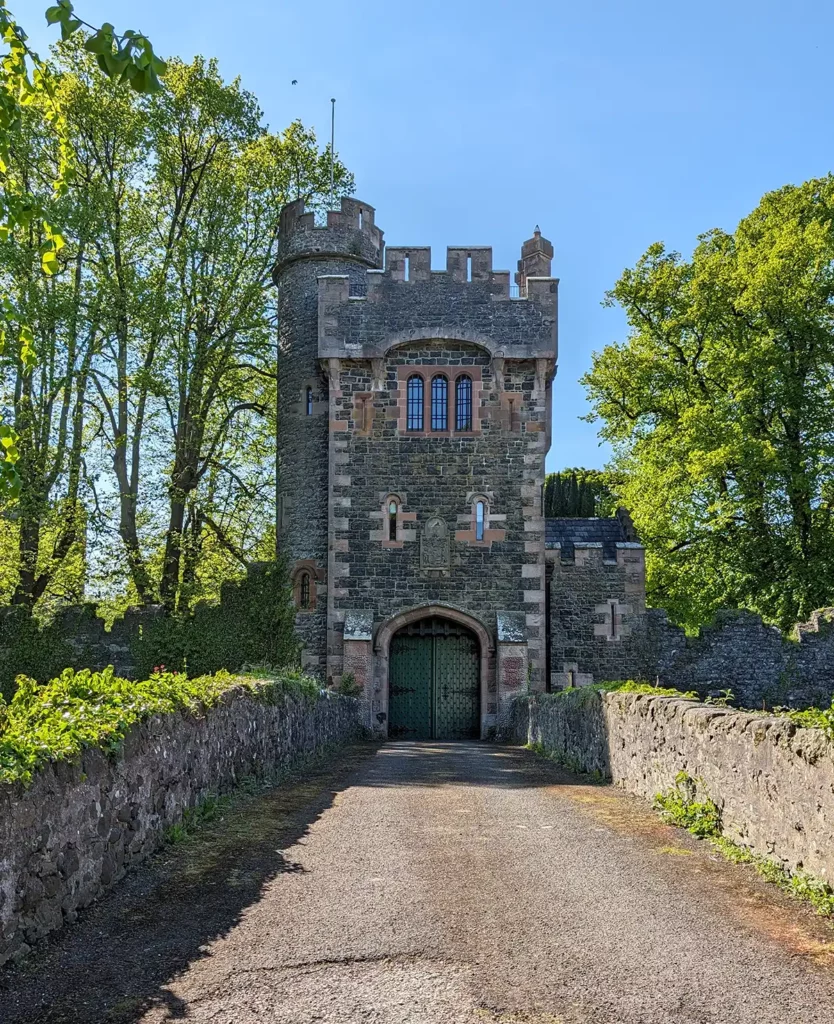
Stop 1: Carrickfergus Castle
The first major stop on the Causeway Coastal Route on the way out of Belfast is Carrickfergus, a large town which is one of the oldest in Northern Ireland.
There’s a big car park right by the very impressive, over 800 year-old castle, and even if you don’t go into the castle to see the keep, banquet hall and armoury, it’s still worth a stop to admire it from the outside.
We walked along the harbour wall to the old radar tower, then stocked up on car snacks at the big Sainsbury’s next door.
At Whitehead, the road takes a sharp left as you cross the bottom of the Islandmagee peninsula. If you set off early on day 1, then you might be able to squeeze in a trip to the Gobbins cliff path, a spectacular guided coastal hike around (and through!) the dramatic cliffs overlooking the Irish Sea.
The next big town is Larne, which is where you’ll arrive if you come to Northern Ireland by ferry from Scotland. On the outskirts of Larne, the scenery really steps up as you head north on the A2 Coast Road.
Look out for: The Black Arch
Two miles north of Larne, you’ll reach the Black Arch, the first of two short tunnels on the Causeway Coastal Route up to Ballycastle. The Black Arch, also known as Blackcave Tunnel, guards the entrance to the most picturesque part of the Antrim coast road.
There isn’t really anywhere to stop here, but if the road is quiet you may be able to pull over if it’s safe to do so.
Stop 2: Drains Bay
Less than a mile after the Black Arch, coming into Drains Bay gave me my first “oh wow” of our road trip. Drains Bay is a wide, shallow bay like several on the route, but this is the first one you’ll see. The slightly grim name Drains Bay is thought to come from the Irish Draighean, meaning ‘blackthorn’.
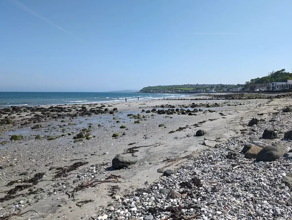
Drains Bay is a lovely place to stop and take a few gulps of sea air on the sandy beach. There’s a big car park on the opposite side of the road to the beach, with clean public toilets, and (when I was there at least) an ice cream van and a couple of food trucks. The road is so close to the sea here that it feels almost like you’re driving along the beach.
There’s another car park a little further along with lovely views out to sea. Like most of the car parks on the Causeway Coastal Route, this one isn’t signposted – if you want to stop you’ll need to be on your toes!
Look out for: O’Haloran’s Castle
Just after you round the headland north of Carnfunnock Country Park, look out on the right hand side for the ruins of the 13th century O’Haloran’s Castle.
Look out for: Ballygally Castle
Ballygally Castle is on the left hand side of the road as you drive through the small village of Ballygally. Ballygally Castle was built in 1625 by James Shaw, a Scot who arrived during the Plantation of Ulster, when Scottish and English people were encouraged to emigrate to Northern Ireland in an effort to make the island of Ireland friendlier towards King James I.
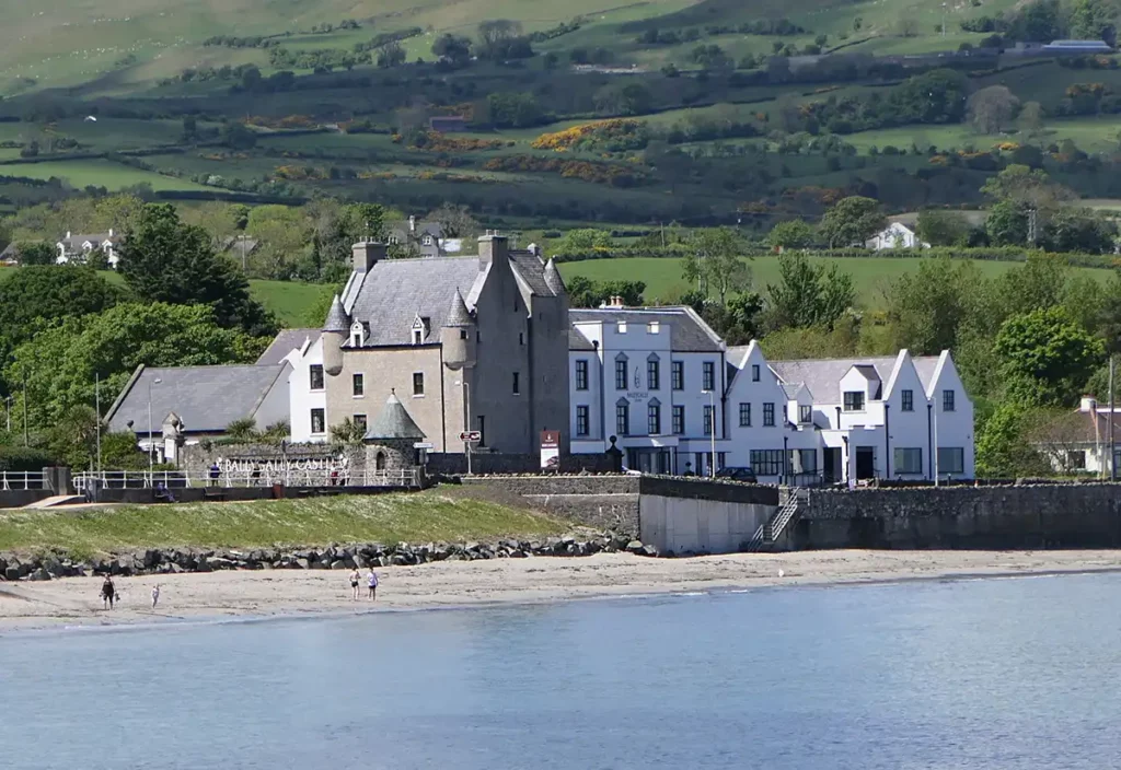
The Castle has a particularly Scottish look about it, with turrets on its corners. It’s now a hotel, with a resident ghost, Lady Isabella. Lady Isabella gave birth to a baby girl but fell out of favour with her husband, who locked her in one of the towers. She now wanders the hotel corridors at night, knocking on doors and looking for her baby girl.
It’s a whole 7 miles to the next stop so you might be relieved to hear that Ballygally Castle has a restaurant which is open for lunches and afternoon teas.
Stop 3: Glenarm
Glenarm is a village with a pretty beach, a little marina and a castle. The castle’s walled garden, stables and other old outbuildings have been turned into a visitor attraction, with little shops, an ice cream parlour and a really nice cafe. You can occasionally visit the castle itself.
The castle’s old barbican, which sits majestically at the end of a bridge across the Glenarm River is available as a holiday let through the Irish Landmark Trust.
On the edge of the village, footpaths lead into Glenarm Forest, one of the nine Glens of Antrim. There are a range of walks and there’s a chance you could see red squirrels.
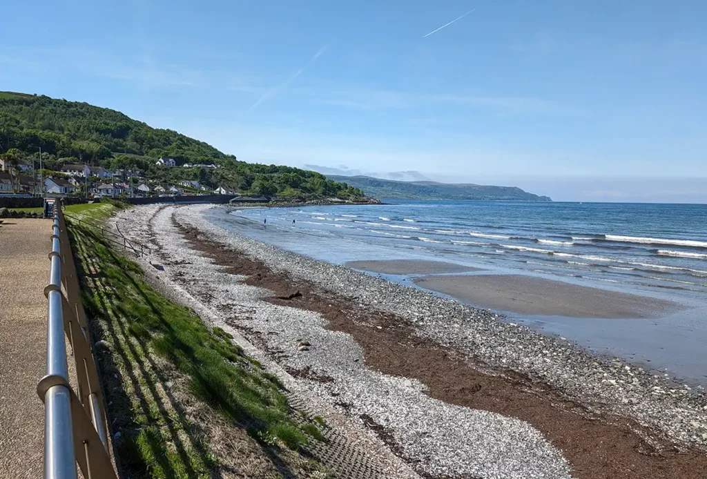
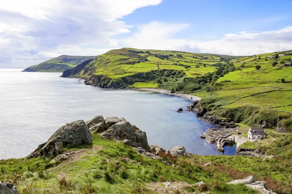
Look out for: Carnlough Bay
Two miles beyond Glenarm you’ll reach lovely Carnlough Bay, another of the big sweeping bays that the Antrim Coast does so well.
If you have time, there’s a car park on the edge of the village where you can leave your car and walk to Cranny Falls.
Stop 4: Garron Point
Between Carnlough and Waterfoot, the A2 road hugs the rocky coast with sweeping, gasp-worthy views. If you want to stop for a while to take it all in properly, there’s a small car park at Garron Point.
Stop 5: Hidden Village of Galboly
A mile and a half on from Garron Point, a small unofficial layby on the left hand side of the road marks the access to the Hidden Village of Galboly. A 20 minute walk uphill takes you to the abandoned village which was used as a filming location for Game of Thrones. You can carry on further up the mountain for amazing views of the coast and surrounding countryside.
The village is on private land, so be sure to leave a small donation for your visit in the blue box at the gate.
Stop 6: Ardclinis Church
Ardclinis Church is a quick optional stop just under a mile from the Hidden Village of Galboly layby. The medieval church is a ruin, and there’s a hawthorn tree where previous visitors have hung prayers and mementos in remembrance of loved ones. There’s a small car park just off the main road.
Look out for: The White Arch
Just before you enter Waterfoot, you’ll pass the White Arch, a remnant of a narrow gauge railway which used to carry iron ore from mines at the top of Glenariff to the sea, where ships would carry the ore off to Glasgow, Cumbria and South Wales for smelting.
If you’re ready for another stop, there’s a car park by the beach in Waterfoot with play equipment and picnic tables. The view back to the steep cliffs is gorgeous.
Look out for: The Red Arch
Leaving Waterfoot on the Coast Road, you’ll pass under a tall, slender arch in the cliff. Unfortunately there’s no parking here so you might want to designate a passenger to take photos! The Red Arch was cut through the sandstone headland by 1817 by landlord and philanthropist Francis Turnley, who wanted to make the journey from his home in Carnlough to his land in Cushendall easier.
You can’t see it from the road going north, but there’s a ruined castle on the cliff above which dates back to the 12th century.
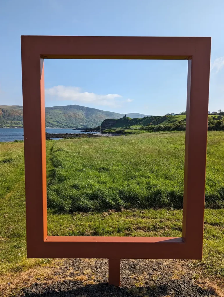
Stop 7: Red Bay
For a view of Red Bay castle, the cliffs and the glen of Glenariffe disappearing into the distance, stop at the small car park just after the Red Arch. There’s a metal picture frame on the edge of the car park which perfectly frames the view.
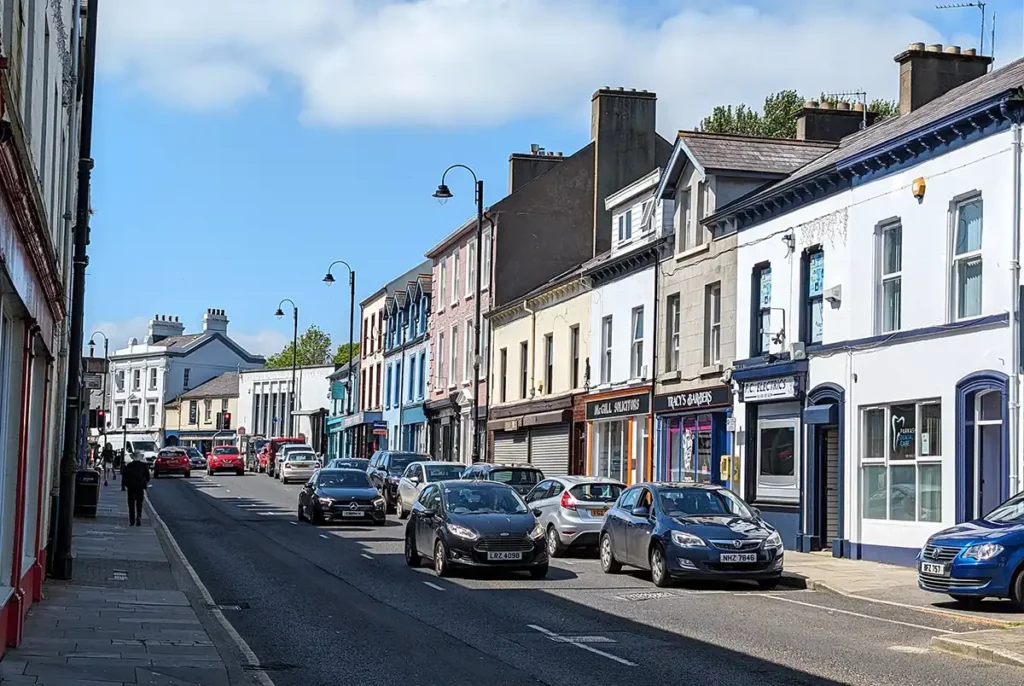
Stop 8: Cushendall
If you need something to eat, some petrol or a toilet break, stop in Cushendall, a pretty village on the coast road with a good range of facilities and a pretty beach.
The Curfew Tower in the centre was built by Francis Turnley (the man behind the Red Arch) in 1817. It’s owned by Bull Drummond from 90s electronic band the KLF and is occasionally used as an artists retreat.
From Cushendall, the Causeway Coastal Route heads inland before reaching the coast again at Cushendun.
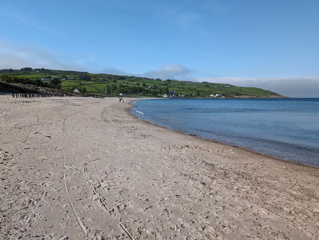
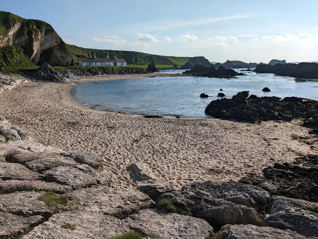
Stop 9: Cushendun and Cushendun Caves
Cushenden was one of my favourite places to stop on the Causeway Coastal Route. It’s a tiny village where the River Dun meets the sea at the foot of Glendun. It’s mostly owned by the National Trust and has a beautiful beach, the remains of a castle and a couple of places to eat (including Mary McBride’s, which was once one of the smallest pubs in Ireland).
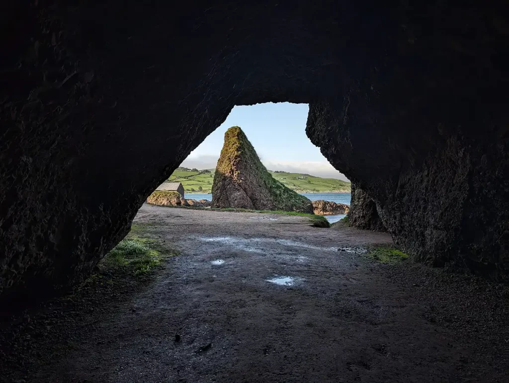
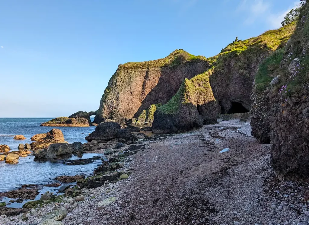
The main reason to stop in Cushendun is for the Cushendun Caves, a dramatic and freely-accessible network of caves on the shoreline just south of the village. The caves are an easy 5-10 minute walk from either of the village’s two car parks, and once you get there, there’s a good chance you’ll have them to yourselves.
The Cushendun Caves are on many Causeway Coast itineraries thanks to their use as a Game of Thrones location. You can see them in season 2, when Melisandre gives birth to a shadow baby, and again in season 8 when they feature in the battle between Jaime Lannister and Euron Greyjoy.
Look out for: Glendun Viaduct and the Vanishing Lake
From Cushendun to Ballycastle the main road takes an inland route, crossing Glendun on the beautiful Glendun Viaduct. Make sure you look up and down the glen while crossing the viaduct!
Look out for: The Vanishing Lake
From Glendun, the road winds up to moorland. Just before you enter Ballypatrick Forest you’ll see Loughareema (The Vanishing Lake) – or perhaps you won’t! This enigmatic lake has three streams running into it, and none coming out, but frequently drains through a sink hole in the middle of the lake. One day you could see it full, the next completely empty.
Optional detour – Torr Head
If you’re up for some smaller roads and spectacular views, take a detour along the Torr Head Scenic Route for more beautiful coastal views across to southern Scotland.
Torr Head is the closest point in Northern Ireland to Scotland; from here it’s just 12 miles across the Sea of Moyle to the Mull of Kintyre. On a clear day you can see Scotland on the horizon.
Overnight stop: Ballycastle
I spent quite a while looking for the best place to stay for the Causeway Coast, and settled on Ballycastle. Ballycastle is a small town on the north coast in a good location for breaking up your trip from Belfast. There’s a good range of accommodation, plenty of shops, restaurants and pubs, and a supermarket for if you’re self-catering.
Day 2: Ballycastle to Portrush
While the road in the northern part of the Causeway Coast doesn’t hug the sea as it does further south, it’s still a beautiful drive. This section is where you’ll find most of Northern Ireland’s most famous attractions, and because they’re so close together you can see lots of them in a single day.
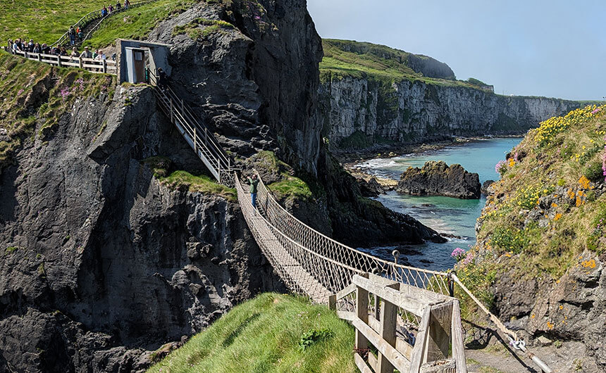
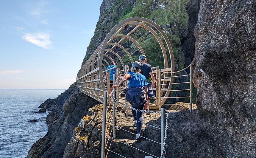
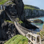
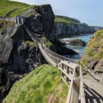
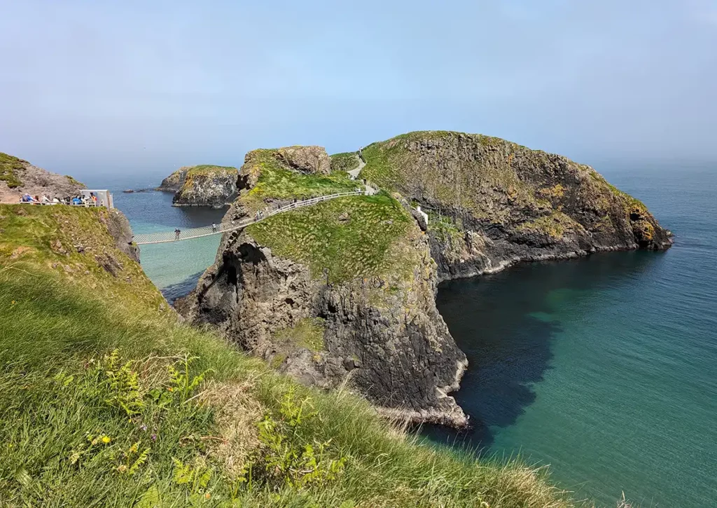
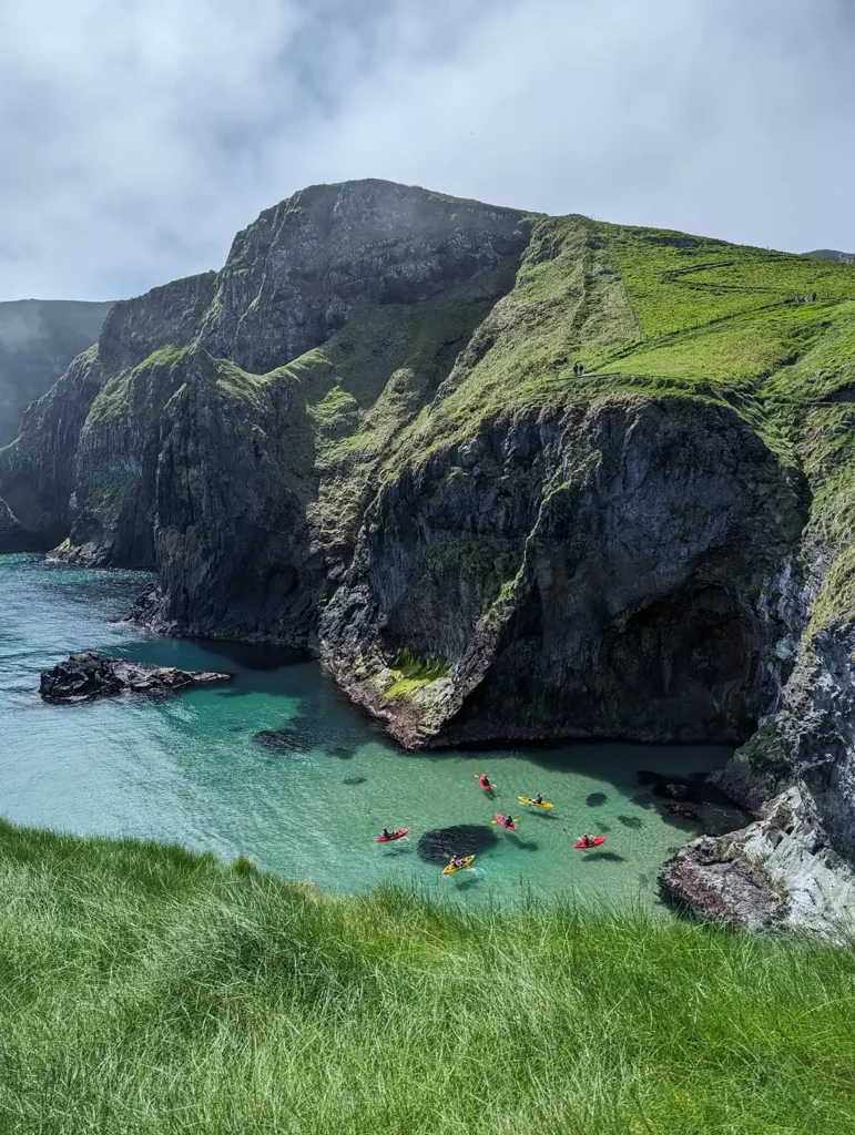
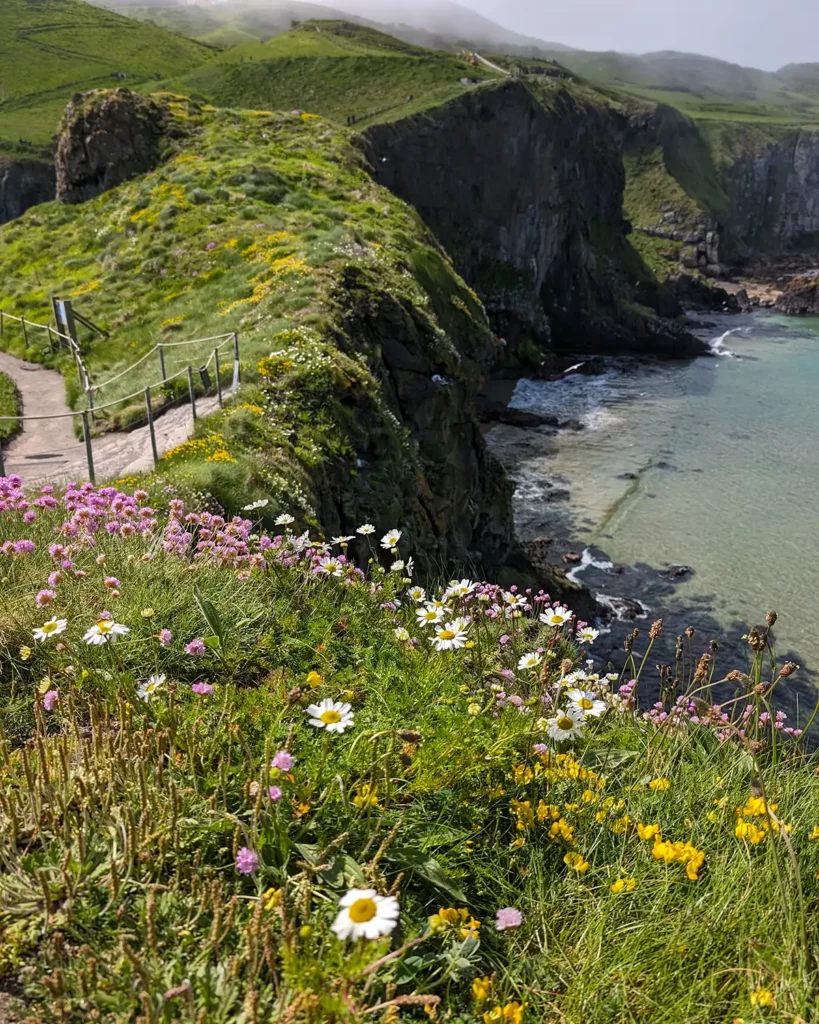
Stop 1: Carrick-a-Rede Rope Bridge
The famous Carrick-a-Rede rope bridge was my favourite place on the Causeway Coast route. The area is owned by the National Trust and it’s essential to book in advance if you want to cross the bridge. It’s less than 6 miles from Ballycastle though, so it’s easy to make it your first stop so you have the rest of the day to spend as you please.
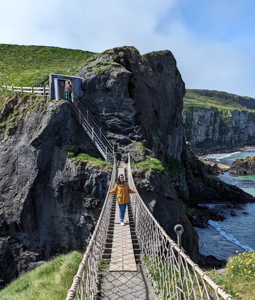
The bridge is around 15 minutes’ walk from the car park along a very lovely cliff-side path. We had a gorgeous sunny day for it and the sea was a shade of turquoise I don’t think I’ve ever seen in the UK before.
The bridge crosses a narrow gap to a tiny island where fishermen used to catch migrating salmon. The first bridge was built over 250 years ago and the last fisherman left in 2002. During my visit in May, the island was covered in wild flowers.
If you just want to see the bridge and not go across you can; there are a couple of nice viewpoints and it’s still worth visiting. Crossing the bridge costs £15.50 per person during peak times and includes car parking. There’s a nice café in the car park which serves drinks and light meals.
Read my complete guide to visiting the Carrick-a-Rede bridge
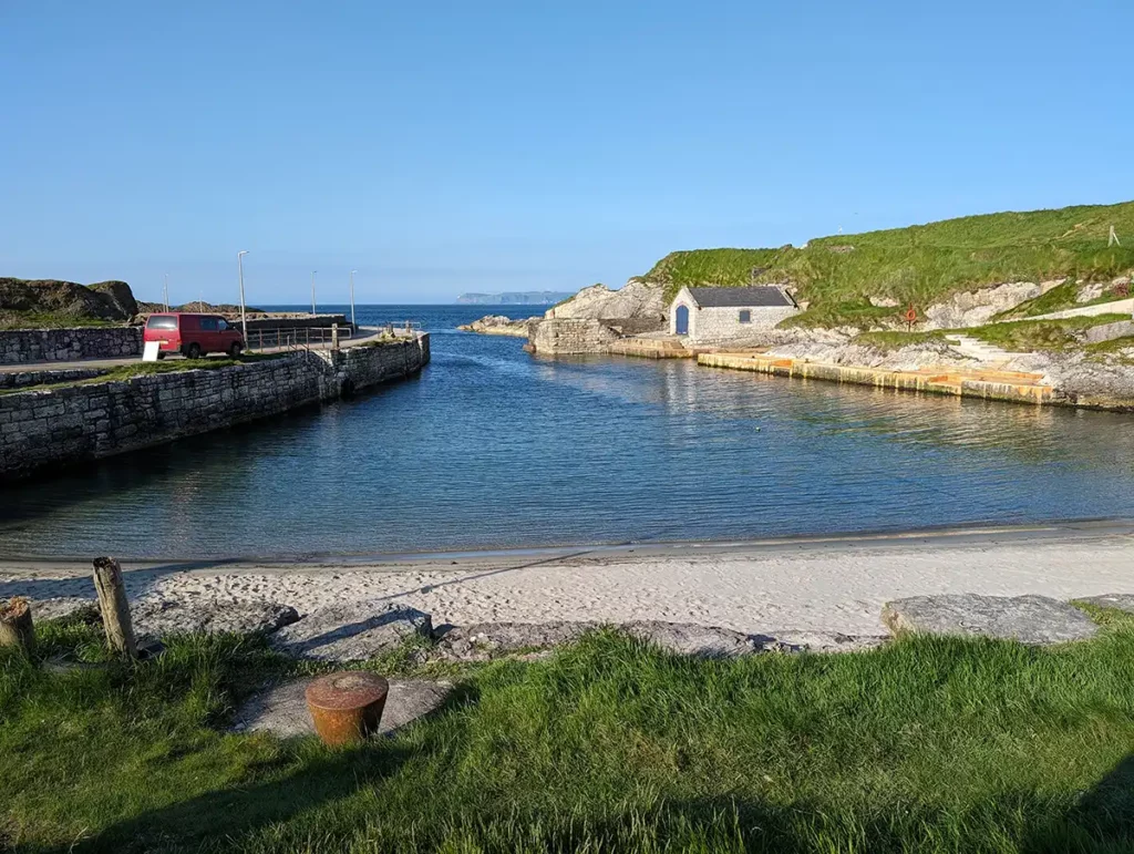
Stop 2: Ballintoy Harbour
Ballintoy Harbour is only 5 minutes’ drive from Carrick-a-Rede. The road down into the harbour is very narrow and therefore only suitable for cars. On your way down to the harbour, don’t miss pretty Ballintoy church and Bendhu House, which is covered in windows to make the most of the gorgeous sea views.
The picturesque harbour were used as a location for the Iron Islands in Game of Thrones so it’s a very popular stop on the Causeway route. There’s a short, pretty walk along the harbour edge, where you can see the waves crashing onto the rocks on the other side of the wall.
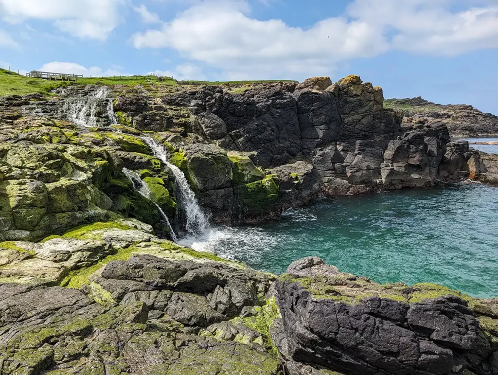
Stop 3: Dunseverick Castle and Falls
Dunseverick is a ruined castle in a stunning position. The castle perches on a high basalt column, surrounded on three sides by the sea, and has been fortified since the 5th century AD.
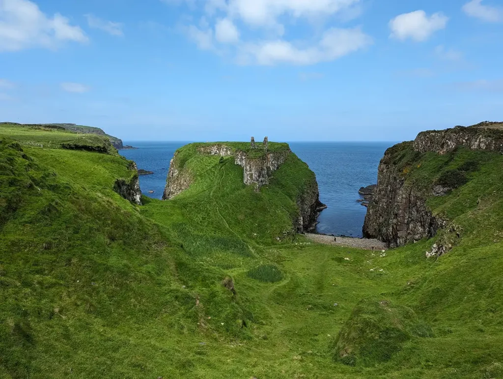
Once you’ve seen the castle, carry on along the coastal footpath for around 10 minutes until you cross a little bridge, then follow the stream down to the rockpools below. If you look back towards the bridge, you’ll see Dunseverick Falls (map), a magical waterfall in a very peaceful location.
There’s a small car park with space for around 15 cars by the entrance to the coastal path. The castle is looked after by the National Trust but entry is free.
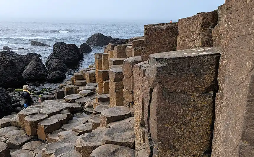
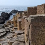
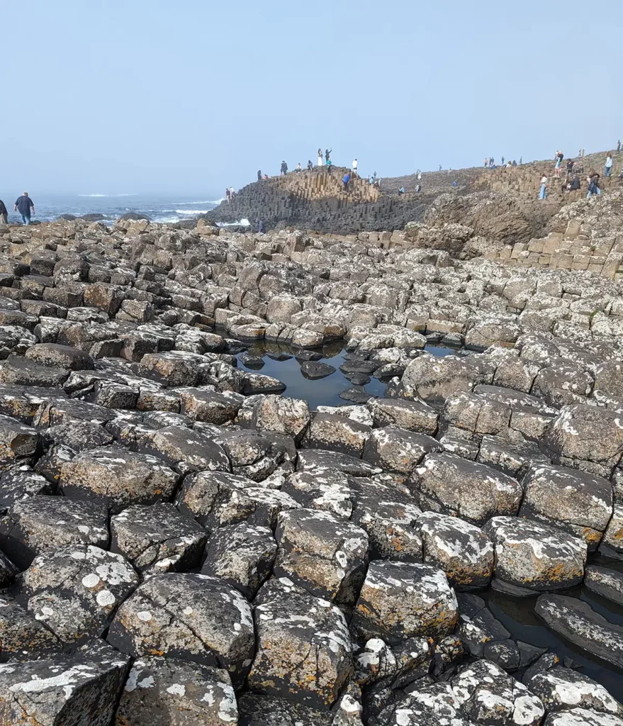
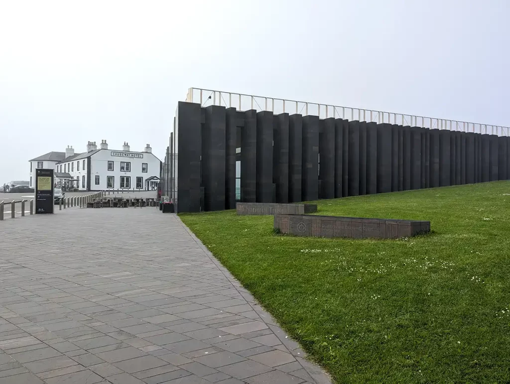
Stop 4: Giant’s Causeway
The Giant’s Causeway Visitor Centre is 6 minutes’ drive from Dunseverick. Like Carrick-a-Rede, you’ll need to leave your car in the car park then walk 15-20 minutes down to the main attraction. Unlike Carrick-a-Rede, where you have to walk, the Giant’s Causeway has the option of a shuttle bus.
The Giant’s Causeway is a UNESCO World Heritage Site, one of only two in Northern Ireland. Located at the base of basalt cliffs, it’s made up of around 40,000 interlocking basalt columns which were formed during volcanic eruptions 50-60 million years ago.
We’d joined the National Trust at Carrick-a-Rede so we got free parking and entry to the visitor centre; the parking was handy but I don’t recommend paying to get in to the visitor centre. There’s a gift shop and café which are both only accessible for people who have visitor centre tickets, along with a slightly half-hearted exhibition. Entry also includes a pretty rubbish audio guide which we ditched after a few stops. There are toilets inside the visitor centre, but there are some more toilets outside that you can use without paying to enter the visitor centre.
The visitor centre costs up to £15.50 per person but there are other car parks nearby which cost £10 per car. If you’re feeling energetic, you can walk from Dunseverick Castle 5 miles away and get in for free. There’s also a little historic railway which runs from nearby Bushmills most weekends and every day in the summer holidays.
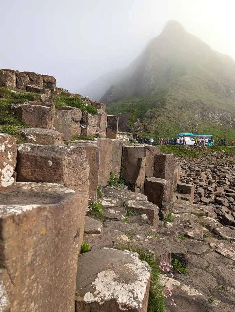
The rocks themselves weren’t quite as perfectly hexagonal as I’d expected but were very cool – they were very similar to the basalt columns we’d seen on the south coast of Iceland. By the time we got to the Giant’s Causeway a mist had started to roll in off the Atlantic Ocean making for some very atmospheric photos. I’d heard mixed reviews of the Giant’s Causeway but I absolutely loved it.
Stop 5: Bushmills and the Old Bushmills Distillery
Bushmills is a small town on the main Causeway Coastal Route, a short drive from the Giant’s Causeway visitor centre, with a range of shops, pubs and restaurants. It’s also home to the Old Bushmills Distillery, the world’s oldest licensed distillery, where they still make Irish whiskeys. You can take a tour of the distillery to see the process, with an optional guided tasting session at the end.
We’d only recently done a tour of the Ad Gefrin whisky distillery in Northumberland so we didn’t do the Bushmills tour this time round, but it gets great reviews online and it’s a fascinating process even if you’re not a whiskey drinker.
Stop 6: Dunluce Castle
Another 6 minutes further on, you’ll find Dunluce Castle perched on a cliff overlooking the Atlantic. I preferred the wild ruins at Dunseverick to those at Dunluce, but it’s definitely worth a stop.
The first castle at Dunluce was built in the 13th century, and it was the seat of the MacDonnell clan until 1690. Dunluce Castle featured in Game of Thrones as the seat of House Greyjoy, albeit with a lot of special effects additions.
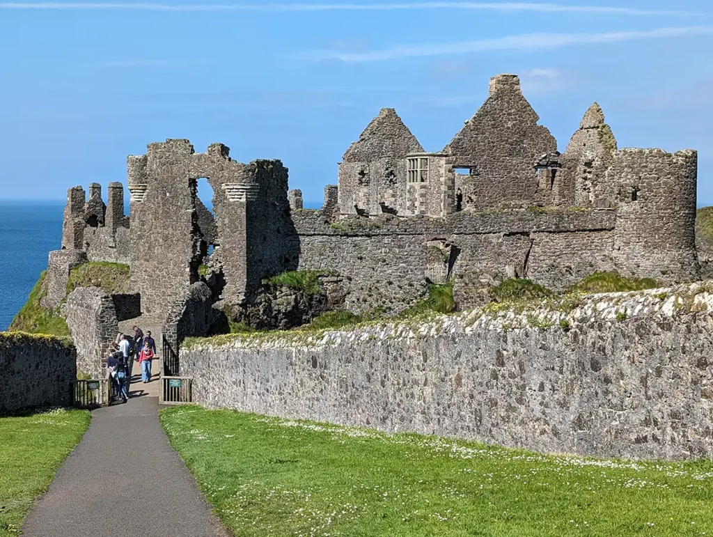
Entry to Dunluce Castle costs £6. There’s a small car park just off the main road. If the car park is full, you could walk from the next stop, Magheracross Viewpoint.
Stop 7: Magheracross Viewpoint
It barely seems worth driving to the next stop as it’s only half a mile away! Magheracross Viewpoint has a large car park so it’s handy for visiting Dunluce Castle on busy days, but it’s also worth visiting for the two circular viewing platforms which jut out over the cliff edge.
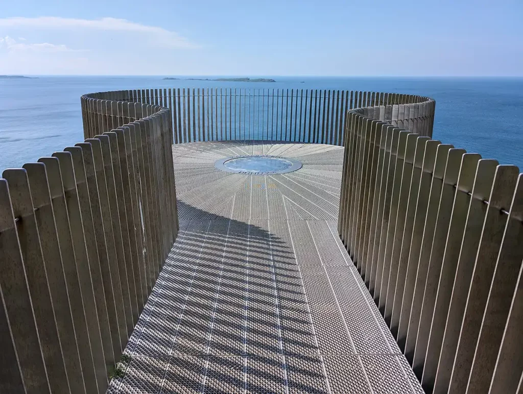
The viewing platform on the right hand side has views of Dunluce Castle, the one on the left has a view of the cliffs leading to White Rocks Beach.
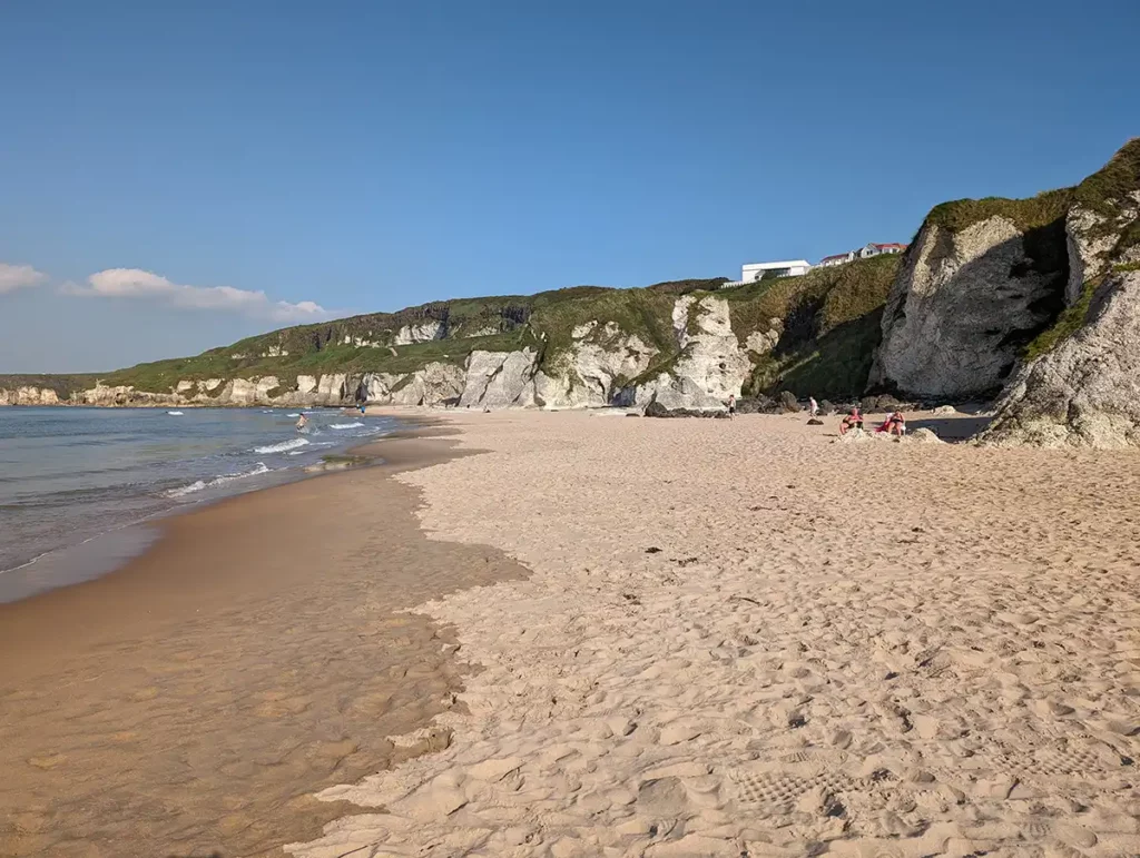
Stop 8: White Rocks Beach
White Rocks Beach is spectacular. The wide sweep of fine, pale sand, pretty dunes and intriguing rock formations make this lovely beach a particularly lovely stop in the summer. It was early evening by the time we got here so the car parks on the way down the hill had emptied out, but there were still a few dog-walkers and families enjoying the sunshine.
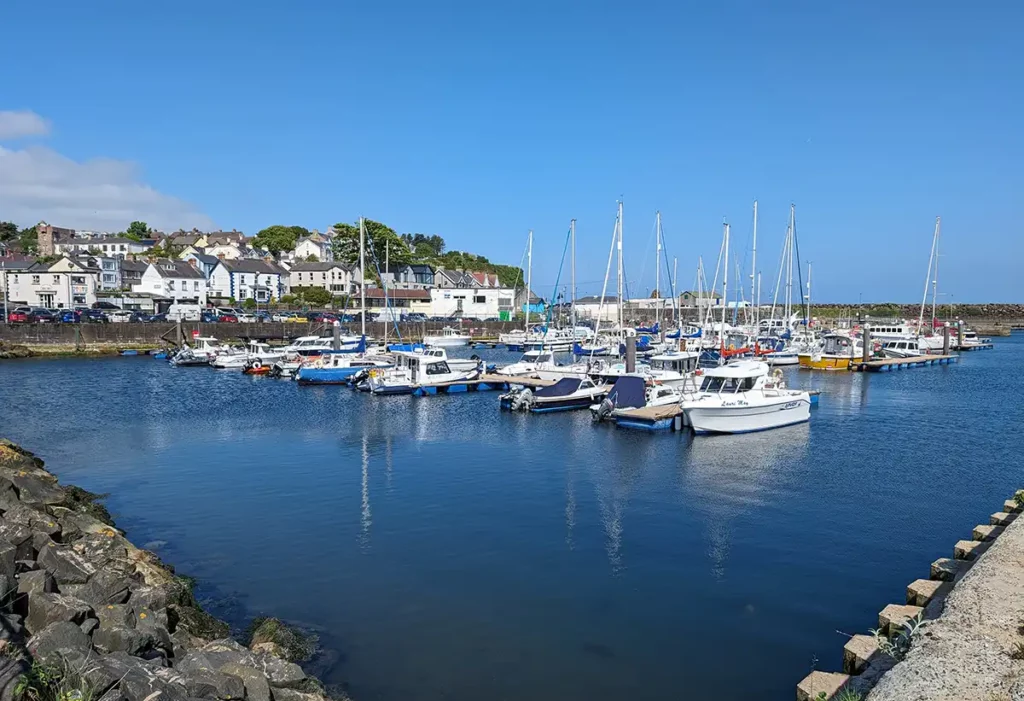
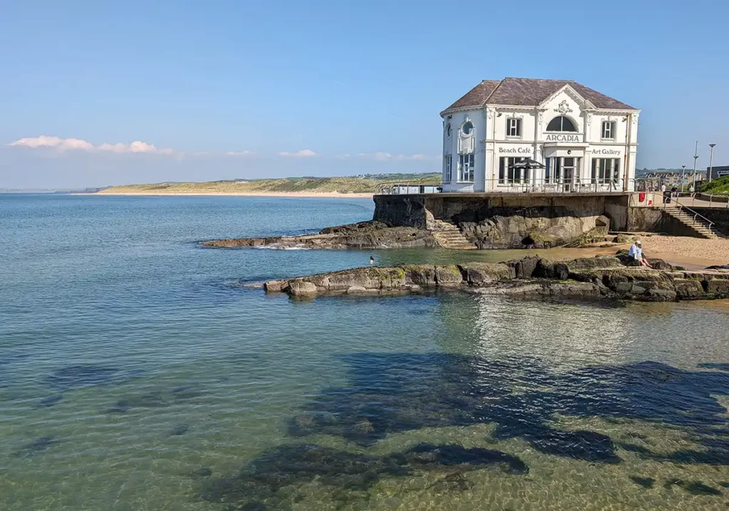
Stop 9: Portrush
Another 6 minute drive along the edge of the famous Royal Portrush Golf Club will see you arriving in Portrush, the largest seaside resort on the Causeway Coast. As well as golf, Portrush has arcades, fish and chips and a harbour where you can take boat trips to see the north coast’s sights from the water.
What about the Dark Hedges?
While pretty much everyone who wants to see the Giant’s Causeway and Carrick-a-Rede bridge will also want to see the Dark Hedges, they’re quite far inland, 16 miles from Portrush and 8 miles from Ballycastle.
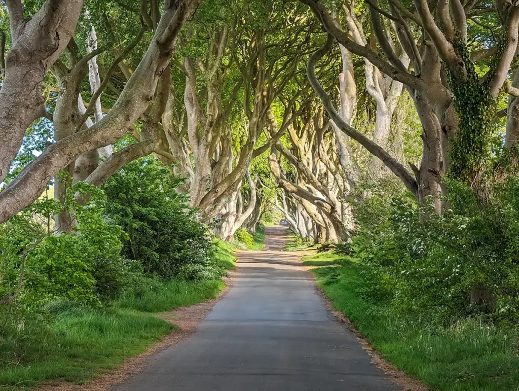
You can no longer drive along the road, so the best way to see the Dark Hedges is to park at the car park (map) by the Hedges hotel. It’s got terrible reviews on Google Maps but it’s really not that bad, it’s just not paved.
If you possibly can, I recommend visiting the Dark Hedges either early in the morning or in the evening to avoid the crowds. We got there at around 7pm on my way back from Portrush to our apartment in Ballycastle; there were only a couple of cars in the car park and a few people walking along the road, making it a much nicer experience than it would have been if it had been full of coach tours. The lower sun in the evening or first thing in the morning also makes the Dark Hedges look particularly atmospheric.
Tips for driving the Causeway Coast
How long does it take to drive the Causeway Coastal Route?
You could drive the whole route from Belfast to Portrush in half a day if you don’t stop, but while you’ll get to see the coast and countryside, you’ll miss out on an awful lot if you just drive past. I recommend a minimum of one full day, starting early and finishing late, or ideally at least two days to fully enjoy the route.
Go in late spring or summer
The best months for a road trip on the Causeway Coastal Route are May, June and early to mid September. It’s not so much that it’ll be cold in winter (although it could be) but the days are just too short to pack many sights in. In December it gets dark by 4pm compared to 10pm in June.
I visited Northern Ireland and drove up the Causeway Coast in late May and it was perfect – we had really long days, the weather was beautiful and everywhere apart from the Giant’s Causeway was relatively quiet.
School holidays start at the end of June or beginning of July in both Northern Ireland and the Republic of Ireland and finish at the end of August so attractions are usually busier in July and August. September can also be a good time to drive the Causeway Coast, although the nights are starting to draw in and it gets chilly towards the end of the month.
You don’t need a big or powerful car
The roads in Northern Ireland are great but some can be narrow, particularly when you’re going down to places off the main road like White Rocks Beach or Ballintoy harbour. If you’re hiring a car, I’d recommend hiring the smallest one that will work for your group. Many of the small roads aren’t suitable for caravans or camper vans.
You can rent an automatic car if you’re not used to driving a manual (stick), but they need to be booked well in advance.
Unless your accommodation has a car charger, it’s safer to book either a petrol car or hybrid.
Take it slowish and expect to stop often
The whole drive up the Antrim coast from Carrickfergus to the Giant’s Causeway and beyond is one of the most beautiful you can ever hope to experience. Every turn of the road reveals another gorgeous view that you’ll want to take in.
There are lots of car parks and lay-bys (mini car parks) along the route where you can safely stop, but they’re not very well signposted, so if you’re going too fast you could miss them.
Bear in mind, these roads aren’t only used by tourists, and it can be really annoying for locals to get stuck behind dawdling hire cars. If someone behind you wants to get past, try and pull over and let them go.
Break up the journey with an overnight stay
While there are plenty of coach tours from Belfast which promise to show you the Causeway Coast in a day, I highly recommend taking at least two days to drive the route.
Part of the joy of visiting this part of Northern Ireland is not just hitting the big sights like the Giant’s Causeway, but finding an unexpected favourite spot, like I did with Dunluce Falls. Having a bit more time lets you explore the walled garden in Glenarm, linger on the beach at Cushendun or pause when you see a particularly magnificent vista.
Three days would let you take the drive at a more leisurely pace, or give you an extra day to visit Rathlin Island, which is a short ferry journey from Ballycastle. We stayed in Ballycastle for three nights and used our last day to drive back to Belfast through the Glens of Antrim, visiting the fantastic Gobbins cliff walk on the way.
Where to stay for the Causeway Coastal route
I recommend staying in Ballycastle as it’s a characterful little town with plenty to offer visitors. The Marine Hotel is just across the road from the beach, harbour and Rathlin Island ferry, while Glass Island Ballycastle is a very stylish B&B. The Salthouse Hotel is a sophisticated hotel on the edge of town with sea views.
We stayed in an apartment in the shopping part of town close to The Diamond (the glamorously-named market square) and while I wouldn’t recommend the exact place we stayed, it did have a really good location.
With a supermarket, upmarket grocery store and several butchers, Ballycastle is a great place for self-catering, whether you choose an apartment or one of the many glamping options in the area.
In summary
I had a wonderful time driving the Causeway Coastal Route and I’d recommend it to anyone who enjoys amazing landscapes and history. I couldn’t believe it’d taken me so long to visit this lovely part of Northern Ireland!
I hope this Causeway Coast itinerary has been useful, let me know in the comments if you have any other questions or tips!